
Geotechnocenter (GTC)
Overview
Geotechnoservice was established in 2005 as part of Kazakhstan's uranium-industry development programme for 2004–2030. It was integrated into Volkovgeology JSC in 2016, when the Board of Directors established the Geotechnocenter Branch.
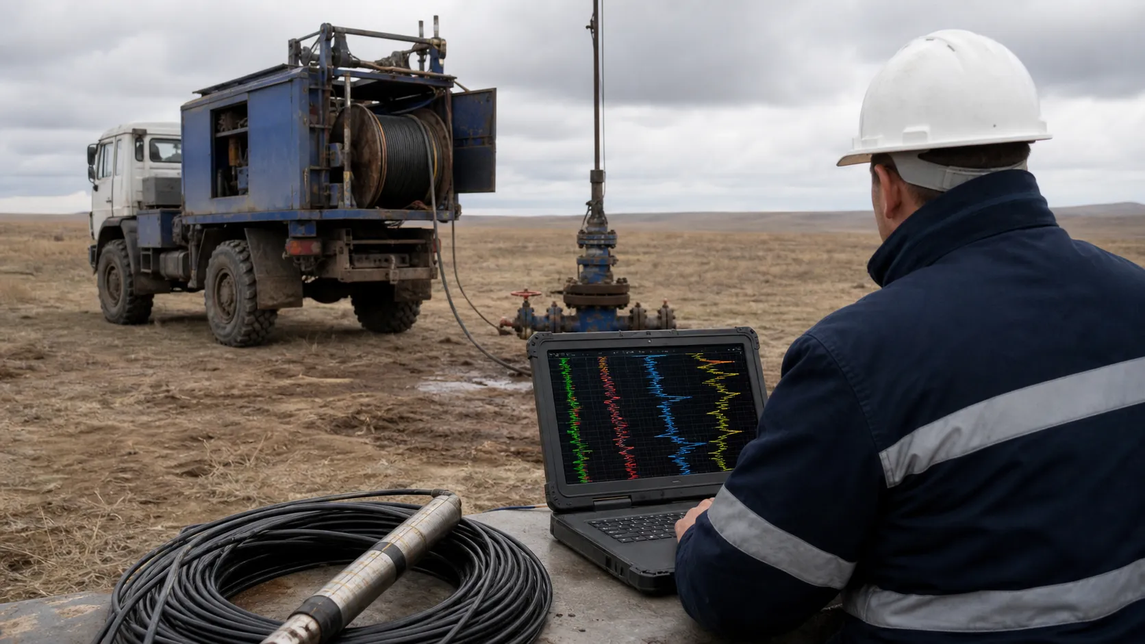
The branch performs integrated geophysical well surveys to determine downhole uranium resources and lithological and filtration characteristics, evaluate rock permeability and casing integrity, identify filter installation intervals and detect radioactive anomalies.
Capabilities
Geotechnocenter has the production, methodological and management resources required to provide well-logging services to uranium mining enterprises throughout Kazakhstan. Its specialist units develop, introduce, maintain and repair geophysical equipment, interpret well-survey data, prepare mining sections of technical projects and perform individual dosimetry monitoring.
Production and business activities
- Integrated geophysical surveys at uranium deposits
- Development, introduction and repair of specialised geophysical equipment
- Preparation of the mining sections of technical designs for commercial development of new deposits
- Preparation of annual mining-work plans for operating uranium deposits
- Individual dosimetry monitoring for Category A personnel
- State re-registration certificate No. 2597-1910-AO dated 26 January 2005
- Decision of the Company's Board of Directors dated 7 September 2016
- State licence No. 15022962 dated 15 January 2015 for individual dosimetry monitoring services
Geotechnocenter branch structure
- Moyinkum and Kanzhugan
- Budenovskoye
- Akbastau
- Zhalpak, Uvanas and East Mynkuduk
- Akdala and Central Mynkuduk
- North Karamurun
- South Karamurun
- Irkol
- South Inkai
- West Mynkuduk
- Zarechnoye
- Kharasan-1
- Kharasan-2
Geotechnocenter · geophysics
Well logging suite
Most geological, technical and geotechnological tasks are solved by integrated interpretation of logging methods based on different physical phenomena. The optimal suite provides reliable data on uranium ore intervals, bedding conditions and rock and ore properties, keeps core studies to a minimum and lowers drilling costs.
The mandatory (standard) suite of GR, AR, SP and DEV is run in every well regardless of the stage. The other methods are supplementary and are run selectively, depending on the task. The suite has been proven by many years of practice at sandstone-hosted (roll-front) uranium deposits.
Methods and their purpose
Gamma-ray logging (GR)
The main source of data on ore bodies at every stage: thickness and depth of ore intersections and their uranium concentration.
Deviation survey (DEV)
In all wells deeper than 100 m, the true position of the borehole; in process wells, control of verticality, azimuth and inclination and of the bottom-hole offset from the design.
Resistivity logging (AR, SP)
Apparent resistivity and spontaneous potential logging for lithological subdivision and for identifying permeable rocks and aquitard boundaries; resistivity data are used to calculate layer-by-layer permeability of the productive horizon.
Caliper logging (CAL)
Actual borehole diameter to correct gamma-ray data for drilling fluid and to calculate cement volumes, the reamed zone and the filter gravel pack. Run in 10–100% of wells; where the average diameter in the ore-bearing horizon is stable, the volume may be reduced to 10% of ore wells.
Prompt fission neutron logging (PFN)
Direct determination of uranium in the borehole (10–20% of wells): refining ore body structure and radioactive halos and monitoring the degree of leaching.
Induction logging (IL)
In open hole, identifies thin impermeable interlayers; in cased wells, records conductivity before acidification to track solution migration and locates metal elements of the isolation.
Current logging (CL)
Casing integrity and correct filter placement; after development, filter cleanliness and sump openness.
Temperature logging (TEMP)
Location of the cement ring when the annulus is cemented.
Flowmeter logging (FLOW)
After development, filter performance and injectivity profile along the filter zone in 0.5 m steps.
Methods by stage of work
| Method | Mine development and redrills | Operational exploration | Exploration | Hydrogeology | Wellfield monitoring |
|---|---|---|---|---|---|
| GR + AR + SP | normally mandatory | normally mandatory | normally mandatory | normally mandatory | not performed |
| DEV | normally mandatory | normally mandatory | normally mandatory | normally mandatory | at the discretion of the mine geologists |
| DEV (intermediate) | at the discretion of the mine geologists | not performed | at the discretion of the mine geologists | at the discretion of the mine geologists | not performed |
| CAL (pilot hole) | normally mandatory | normally mandatory | normally mandatory | normally mandatory | not performed |
| IL (pilot hole) | at the discretion of the mine geologists | at the discretion of the mine geologists | at the discretion of the mine geologists | at the discretion of the mine geologists | not performed |
| PFN | at the discretion of the mine geologists | at the discretion of the mine geologists | at the discretion of the mine geologists | at the discretion of the mine geologists | not performed |
| CAL (reamed zone) | at the discretion of the mine geologists | not performed | not performed | at the discretion of the mine geologists | not performed |
| IL (cased hole) | normally mandatory | not performed | not performed | at the discretion of the mine geologists | normally mandatory |
| CL (casing) | normally mandatory | not performed | not performed | normally mandatory | normally mandatory |
| TEMP | normally mandatory | not performed | not performed | normally mandatory | not performed |
| CL after development | normally mandatory | not performed | not performed | normally mandatory | not performed |
| FLOW | at the discretion of the mine geologists | not performed | not performed | at the discretion of the mine geologists | at the discretion of the mine geologists |
- normally mandatory
- at the discretion of the mine geologists
- not performed
Logging at different sites
Process well construction
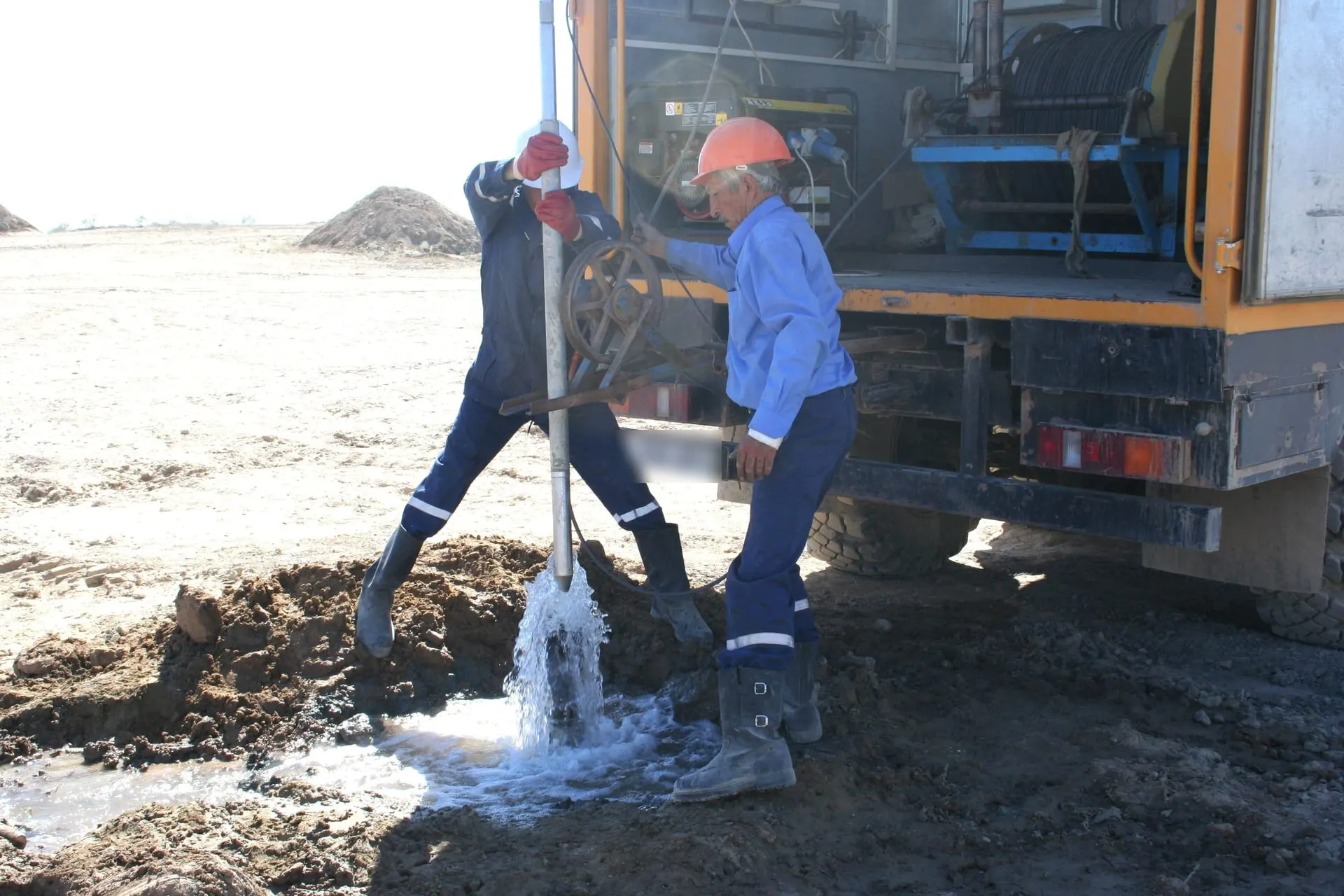
In the open pilot hole a deviation survey comes first (bottom-hole offset check), followed by gamma-resistivity logging, caliper and, if required, IL and PFN. After reaming, caliper of the reamed zone; after casing, current logging; after cementing, temperature logging (IL where bentonite sleeves are used); after development, current and induction logging and, if required, flowmetering. At the discretion of the mine geologists, a check deviation survey is run in the casing on a separate trip.
Exploration and operational exploration wells
The main suite in a single run: GR, AR, SP, DEV, CAL and IL. PFN on a separate request from the mine’s geological service.
Block operation (wellfield)
Current logging before and after workover, induction logging to monitor solution migration, flowmetering, and gamma-ray logging in observation wells to track the movement of radioactive elements during leaching.
Equipment
- Logging station: GIK-1 rack with Vulkan recorder, or UGI
- Logging control and data recording
- KSP combined tools
- KSP-60FH: simultaneous GR, AR and SP; KSP-60I: GR, AR, SP and DEV
- IES and SIEL inclinometers
- Borehole position in space, bottom-hole deviation
- KSU and SKU calipers
- Borehole diameter
- AINK-type PFN equipment
- Direct determination of uranium in the borehole
- RK-type radiometers
- Gamma-ray logging in casing
- PIK induction tools
- Rock conductivity in open hole; metal isolation elements in casing
- SPEK electric probes
- SPEK-1: current logging; SPEK-3: resistivity logging in casing
- TK-type thermometers
- Location of the cement ring
- Flowmeters
- Filter performance and injectivity profile
Workflow
- 1.Registration of the logging request from the customer or the drilling service
- 2.Preparation at the base and travel of the logging station to the site
- 3.Preparation at the well: positioning the station, grounding and power, sheave and depth marker, tool set-up and checks, lowering the tool to the bottom
- 4.Running the logging suite: all methods except temperature logging are recorded from bottom to top
- 5.Rig-down at the well and return to the base
- 6.Acceptance and quality check of field data, processing and delivery to the customer
Data processing
- Rapid processing and preliminary interpretation to decide on further drilling, no later than 3–6 hours after logging, at the workshop or site base.
- Final integrated interpretation after all work on the well is complete; results are issued as ore interval passports and geological columns and loaded into the customer’s database.
- An ore interval passport covers: from GR, radioactive anomalies, the boundaries and thickness of ore intervals and uranium grade with corrections applied; from AR, SP and IL, a lithological column with lithological-filtration types and technologically off-balance layers, aquitard boundaries and the limits of acidification; from CAL, the borehole and reamed-zone diameter; from TEMP or IL, an assessment of the isolation; from CL, casing defects and the position and length of the filter and sump; from FLOW, filter performance and flow rate.
Software
- Alfa
- Integrated interpretation of logging data and ore interval passports
- Kalina
- Borehole deviation calculation from inclinometry data
- Registration 3
- Operating the Vulkan logging station
- Atomgeo, GGIS
- Geophysical databases into which logging data are loaded
Geotechnocenter · research
Research and development
The branch carries out research and engineering work aimed at improving uranium production processes. Its studies cover the geological and geotechnological factors that affect deposit performance, assess the condition of host rocks and production blocks, and produce methodologies, recommendations and engineering proposals for mining companies.
The research is applied in nature: it addresses production tasks, strengthens the basis for technical decisions, identifies the reasons behind falling recovery and improves geotechnological processes.
Completed research projects
Methodological guidance for opening up and mining ore bodies under complex geological conditions at uranium deposits
- Scope of work
- A study of ore body characteristics and of the geological conditions that complicate their development, together with an analysis of the factors that determine the choice and implementation of technological solutions.
- Key outcome
- Methodological guidance and engineering proposals were produced for improving approaches to opening up and mining ore bodies with allowance for the geology of each deposit.
Identifying the causes of underperforming production blocks and developing recommendations for their rework
- Scope of work
- An analysis of why certain production blocks failed to reach their design uranium recovery, and a study of the geological and technological factors behind those results.
- Key outcome
- The causes of reduced recovery were identified and recommendations were prepared for reworking underperforming blocks and increasing uranium recovery.
A methodology for determining the degree of leaching of host rocks and assessing the quality of in-situ uranium leaching
- Scope of work
- A study of approaches to determining how thoroughly host rocks have been leached, to assessing in-situ leaching quality, and to analysing the factors that affect production block performance.
- Key outcome
- A methodology for assessing the leaching of the host environment and the quality of in-situ leaching was developed, along with recommendations for improving production block performance.
Research support for mining companies
Drawing on this experience and expertise, the branch provides research and engineering support in the following areas:
- analysis of geological conditions that complicate the development of ore bodies
- investigation of why production blocks fall short of their design indicators
- assessment of how thoroughly host rocks and the production environment have been leached
- study of the factors affecting the quality and efficiency of in-situ uranium leaching
- analysis and interpretation of geophysical and geotechnological data
- development of methodologies, guidance and engineering proposals
- preparation of analytical materials, research reports and technical justifications
- recommendations for improving production block performance and uranium recovery
Branch documents
Certificate of assessment of measurement conditions in the dosimetric monitoring laboratory
Certificate No. 29/25issued 23.07.2025 · valid until 23.07.2028
Measurement of the personal dose equivalent Hp(10) from external exposure of personnel to ionising radiation. Issued by the Almaty branch of the National Centre for Expertise and Certification JSC.